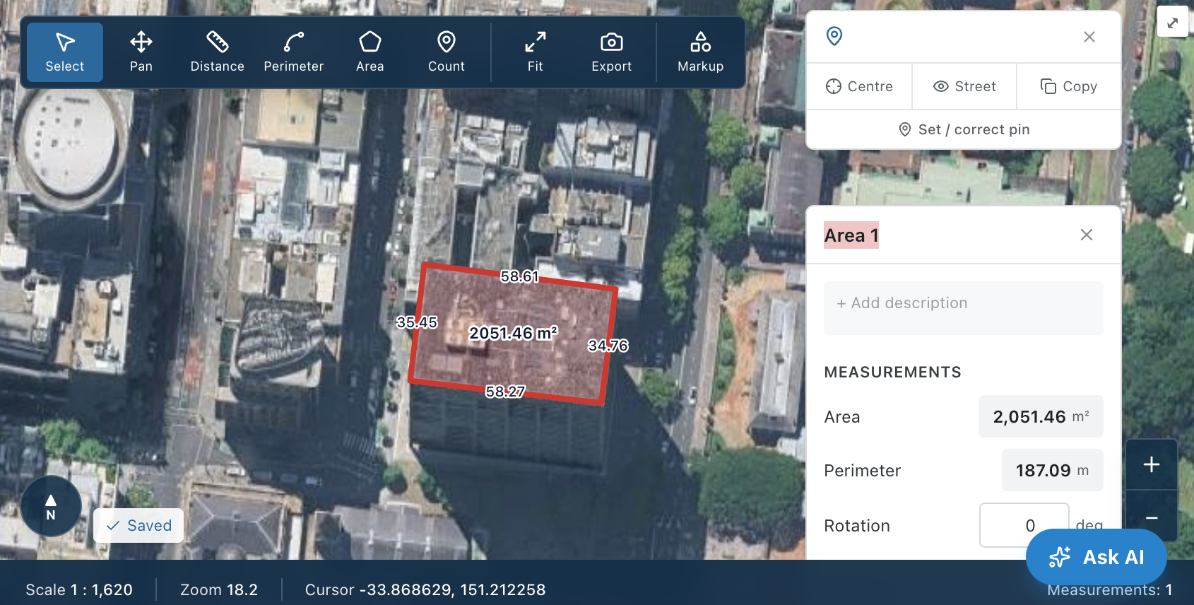
Aerial Map Measure
Measure areas, lengths and boundaries on true top-down aerial imagery, straight from any address.
Map Metra turns your plans, specs and scope documents into a measured, priced and scheduled estimate — in one connected project. Upload everything, let AI set it up, measure, price, program and issue a professional summary.
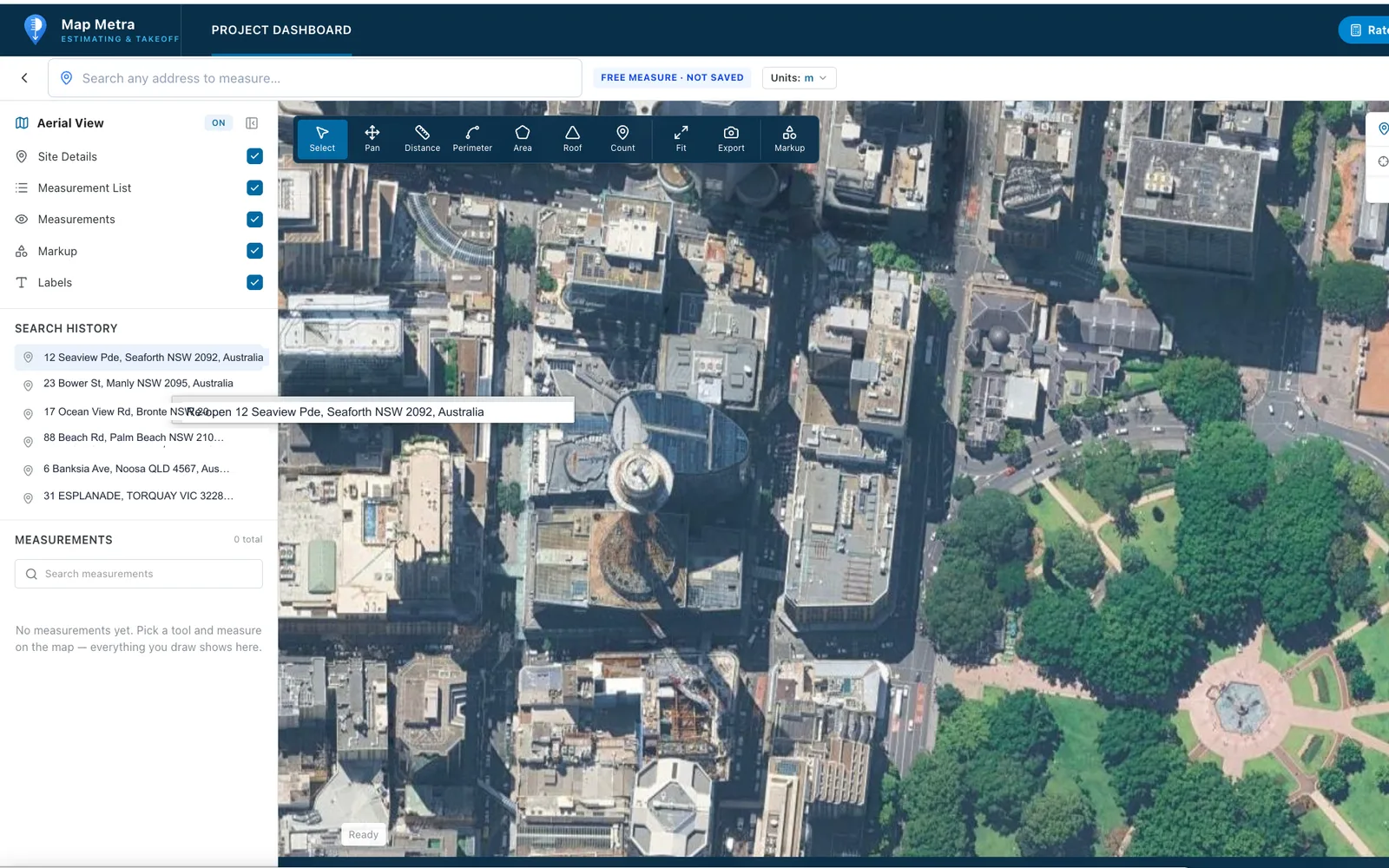
Measure any site straight off the aerial — areas, perimeters, roofs and counts.
Aerial Map Measure
Search an address and measure on high-resolution aerial imagery — right in your browser. Use it as a free, quick measure or connect it to a real project.
Plan Takeoff
Upload PDF plans, set the scale once, and measure areas, lengths, counts and roofs on-screen. Every on-screen takeoff becomes a live quantity you can price — no printing, no scale rule, no double-handling.
Bill of Quantities
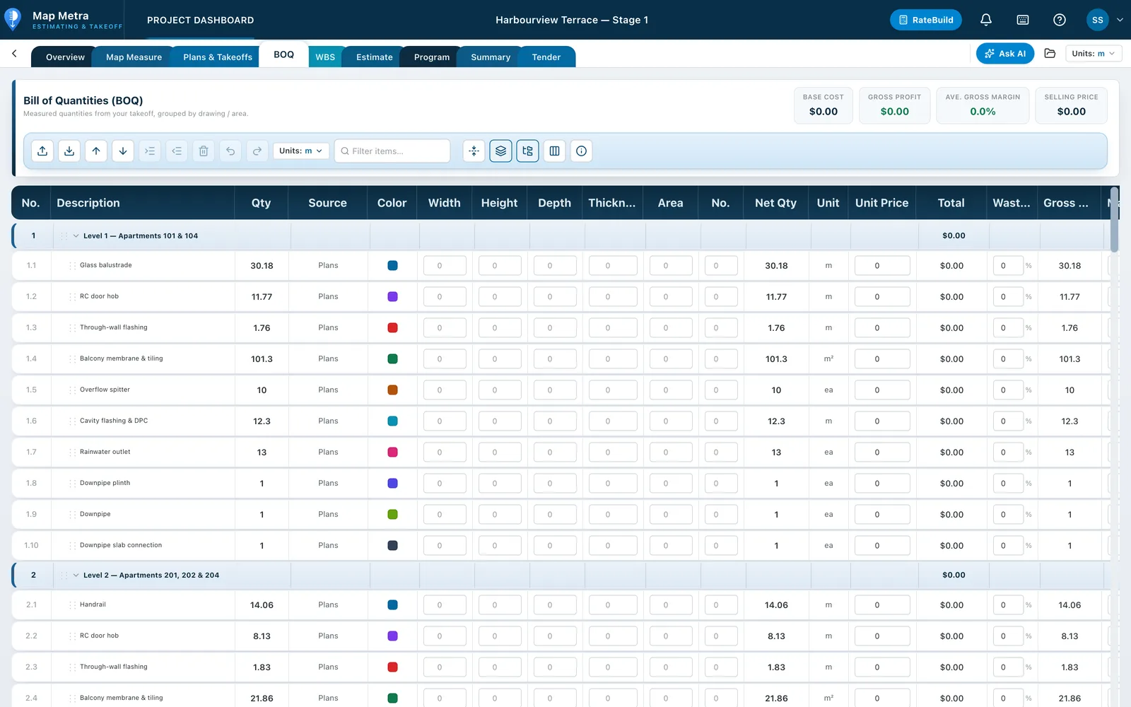
Your takeoff measurements roll straight into a structured Bill of Quantities (BOQ). Apply rates and the sheet totals in real time — a fast, defensible preliminary estimate you can hand up or carry into a full estimate.
Quantities flow from the takeoff · totals update live
Estimate & WBS
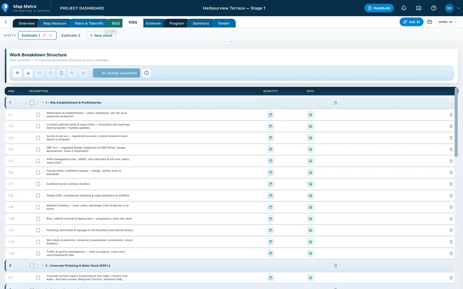
Organise the job into a Work Breakdown Structure (WBS) of trades, sub-trades and activities. Assign BOQ quantities to activities with a live link, so when a measurement changes the estimate follows automatically.
Assign BOQ quantities to activities — the estimate follows
RateBuild
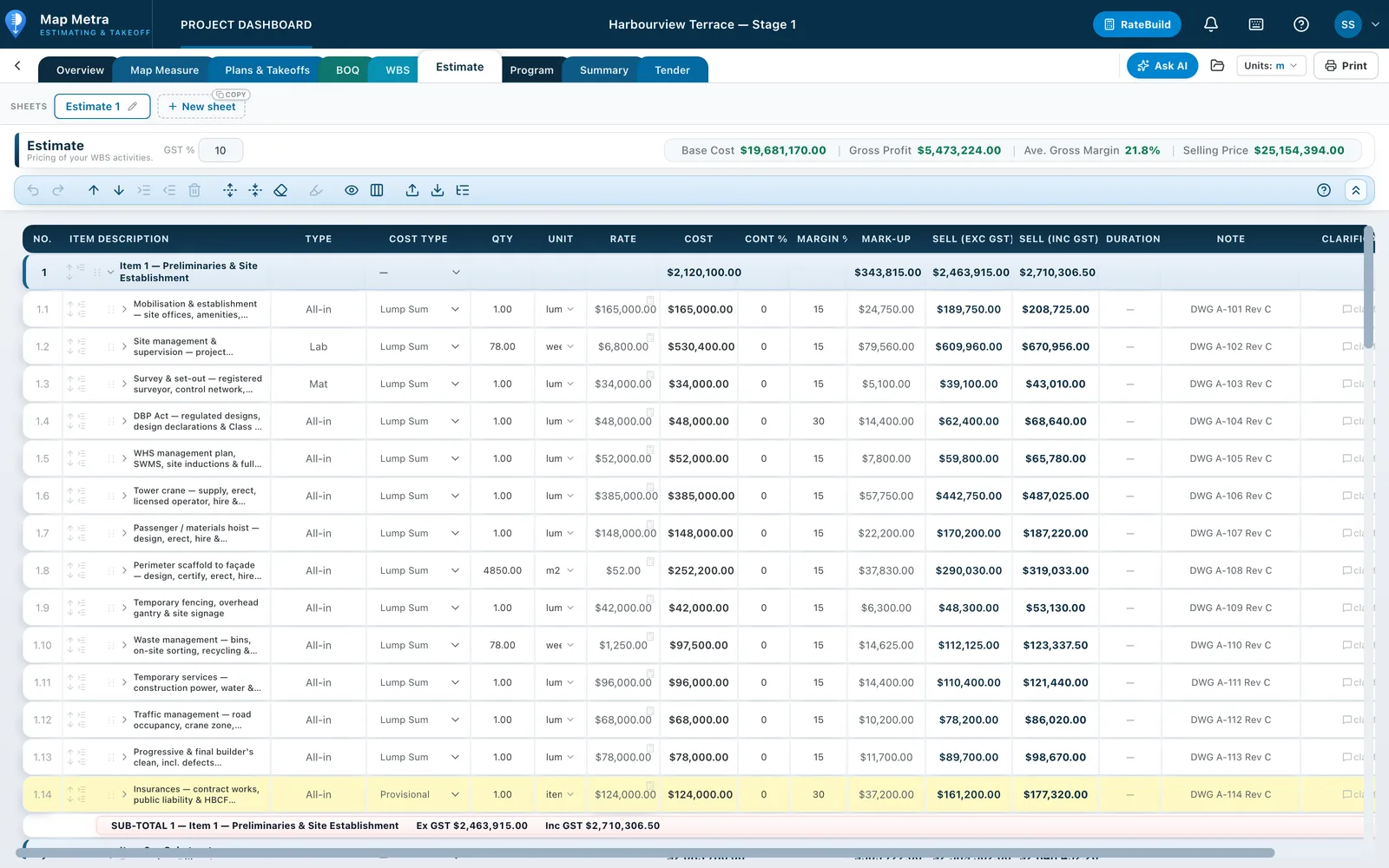
Compose composite unit rates from first principles — labour, materials and plant — then reuse them across every estimate. Your rates live in your own library so you price consistently, project after project.
Reusable across every estimate — your own rate library
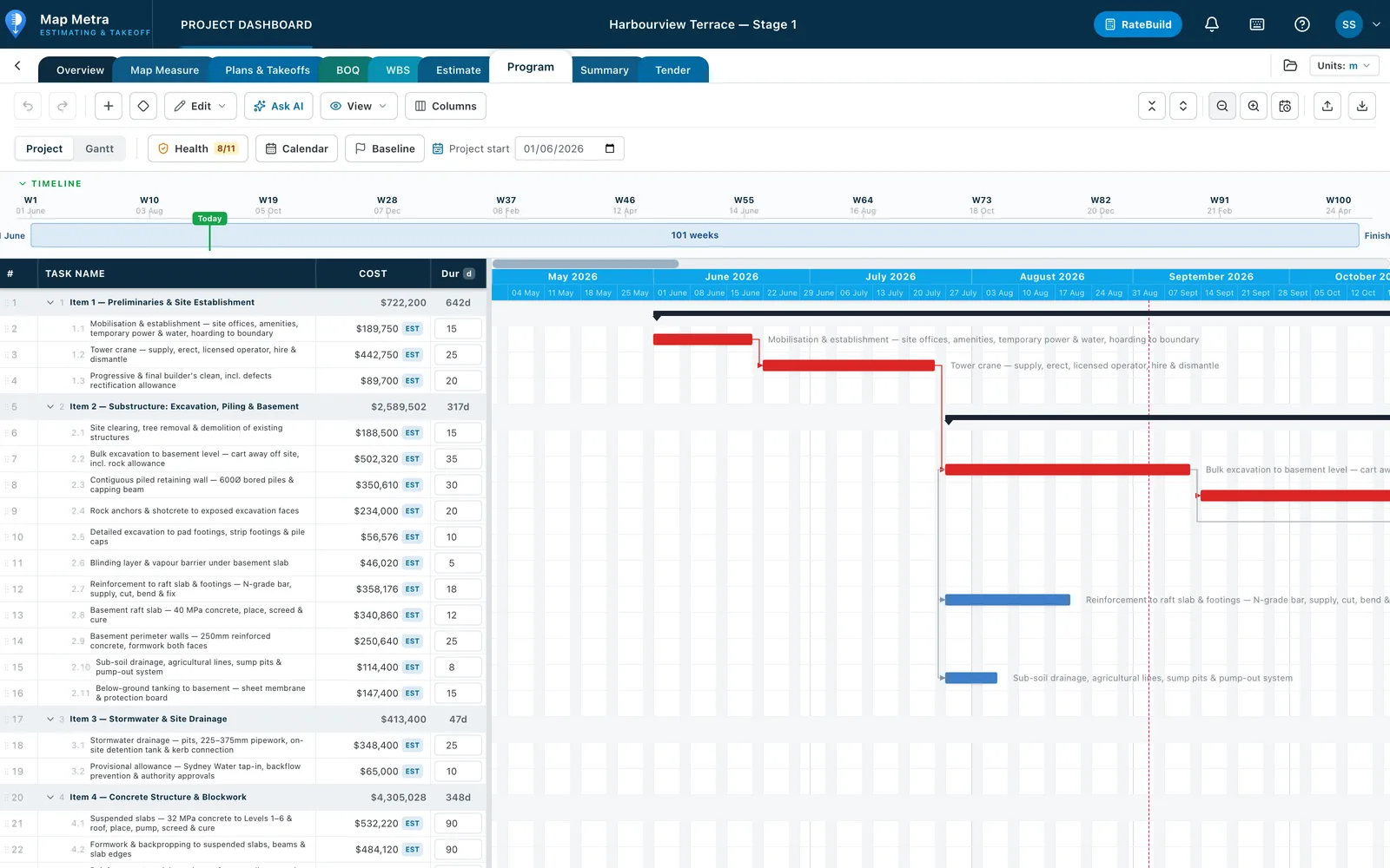
Construction Program
Schedule the job on a working-day calendar with a Gantt chart and an activity-on-node network diagram. Link tasks with FS/SS/FF/SF dependencies and lag; the programme auto-schedules around weekends and holidays.
Auto-scheduled on working days · FS/SS dependencies + lag
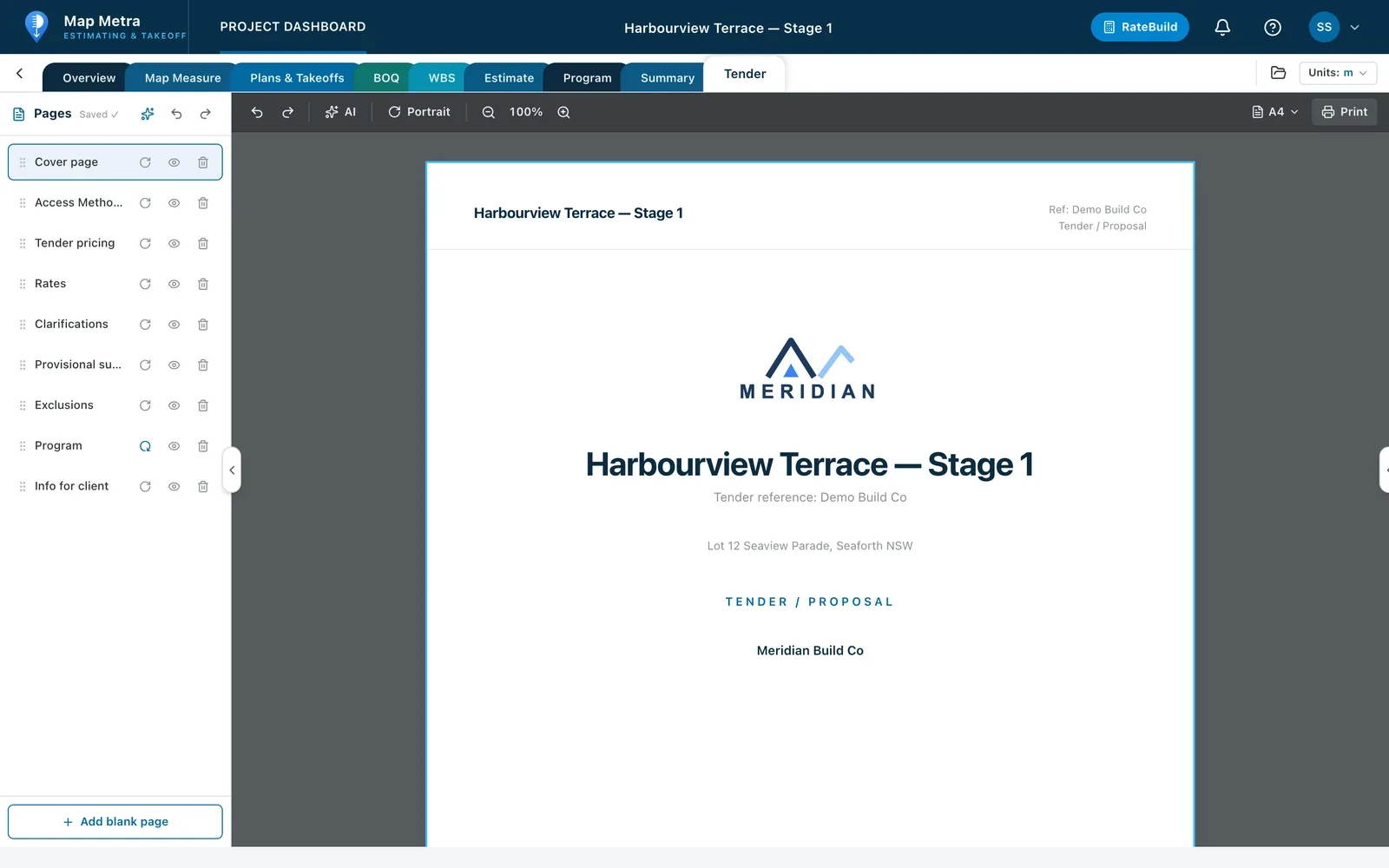
Tender & Proposal
Build a professional A4 tender or proposal document that pulls your estimate, programme and cost summary in live. Add your logo, licences and insurances, then print or export a pixel-perfect PDF.
Estimate, programme & summary flow in live · export to PDF
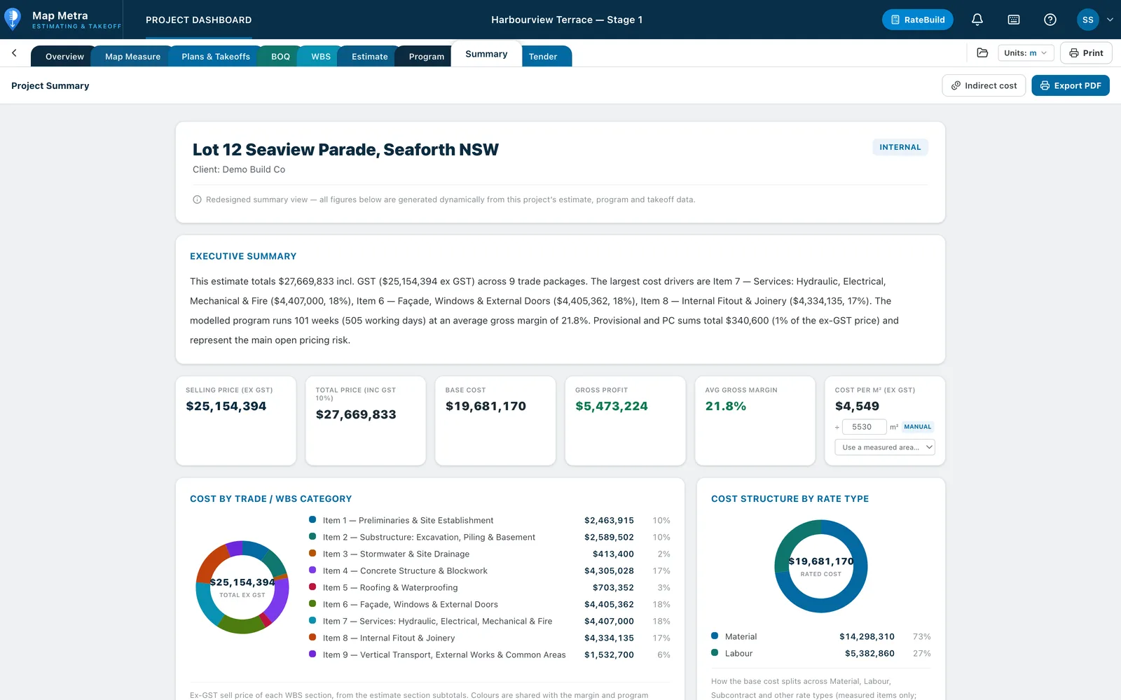
Cost Summary
A live project summary rolls up selling price, base cost, gross profit, margin and GST — with cost-by-trade and cost-structure breakdowns, an indicative programme and a cost per m². Every figure traces straight back to the estimate.
Every figure traces back to the estimate
One connected workflow
Map Metra connects every measurement to the estimate, so quantities flow through to cost, margin and program without re-entry.
Measure areas, lengths and boundaries on true top-down aerial imagery, straight from any address.
AI names and scales your uploaded drawings, so they're ready to measure in seconds.
Trace areas, measure lengths, count items and complete wall, roof and cubic takeoffs on scaled plans.
Measured quantities flow into a BOQ grouped by area, with live cost, profit and margin.
Apply rates or build them from labour and materials, set margins and contingency, and watch selling price and GST update live.
Organise scope and quantities into a WBS that ties measurement to cost and program.
AI builds a construction program from your estimate — durations, dates, calendars and cost on a visual Gantt.
One click produces a client-ready summary: price, margin, cost/m², quantity snapshot and cost-by-category charts.
How it works
Upload plans, scope of works, specs, subcontractor quotes and DAs. AI names and scales your drawings ready to measure and drafts your estimate from the documents.
Search any address and measure areas, lengths and boundaries on true top-down aerial imagery.
Trace areas, measure lengths, count items and complete wall, roof and cubic takeoffs on your scaled drawings.
Measured quantities flow into a Bill of Quantities grouped by area, with live cost, profit and margin.
Apply rates (or build them from labour + materials with RateBuild), set margins and contingency, and watch selling price and GST update live.
AI builds a construction program from your estimate — durations, dates, calendars and cost allocation on a visual Gantt timeline.
One click produces a client-ready summary: price, margin, cost/m², quantity snapshot, cost-by-category charts, claim schedule and provisional sums.
Coverage
Across 30+ countries with true top-down aerial imagery, search any address and drop straight onto the exact property, then measure. New countries are added regularly.
Blue = full nationwide coverage. Lighter = also covered & expanding.
Subscription plans
Take just Map Measure from A$19/mo, just Takeoff from A$131/mo, or the Combo from A$135/mo — for 1, 2 or 4 users, monthly or annual. Every plan includes a 14-day free trial.
Map
Free Aerial Measure — measure straight off aerial maps.
Takeoff
Upload plans, take off & bill.
Map + Takeoff
Aerial measuring plus plan takeoff & BOQ.
All Features
The complete estimating suite.
All prices in Australian dollars. Annual plans include one month free. A card is required to start a trial; cancel anytime before it ends and you won't be charged.
FAQ
You can measure areas, perimeters, distances and counts from aerial maps and uploaded construction plans.
Yes. Map Metra runs in the browser, so your projects can be accessed from supported computers without installing desktop software.
Every new subscription starts with a 14-day free trial before the selected paid plan begins.
Yes. Subscriptions can be cancelled from the account settings before the next billing date.
About Us
Map Metra is a cloud-based product operated by Arasep Projects Pty Ltd. It gives builders, estimators, subcontractors and construction professionals one connected workflow for aerial measurement, plan takeoff and estimating.
Arasep Projects Pty Ltd is the legal entity that supplies the Map Metra service and enters into subscriptions with customers.
Contact Us
Contact Arasep Projects Pty Ltd for product questions, account support, subscriptions or legal notices.